PyWorldAtlas
Offline · source-aware · made for learning
Geography data that feels like ordinary Python.
Explore country profiles, names and writing systems, capitals, cities, physical geography, climate classes, optional interactive 3D maps, coordinates, distances, reviewed land neighbors, rankings, and learning tools from one bundled database. Built for classrooms, curious learners, and developers. No API key and no runtime download.
Documented version: 0.9.5 | Dataset: 2026.07.22.7 | Python: 3.10–3.14 | Profiles: 248
248
country and area profiles
6,265
bundled populated places
0
runtime dependencies
Open the terrain
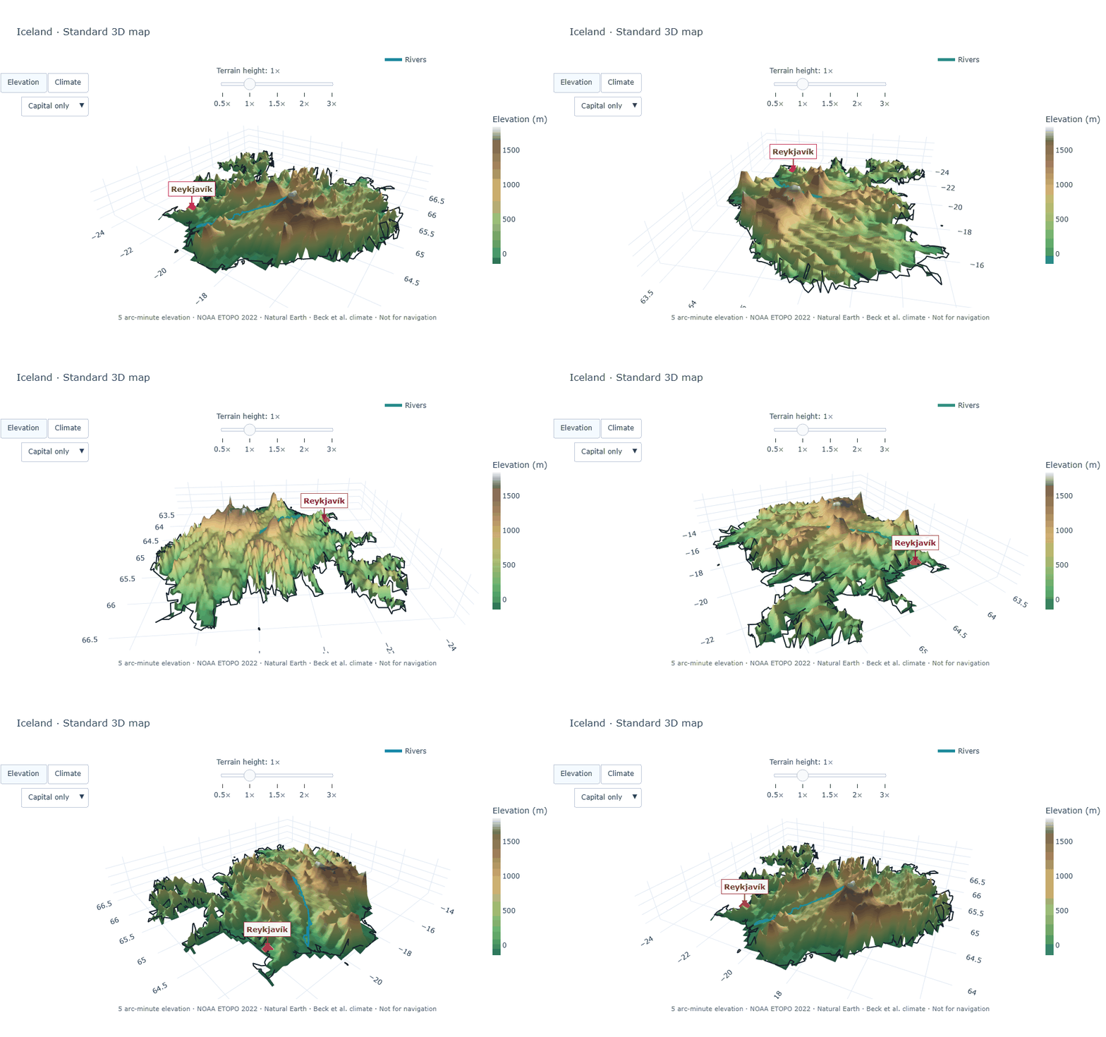
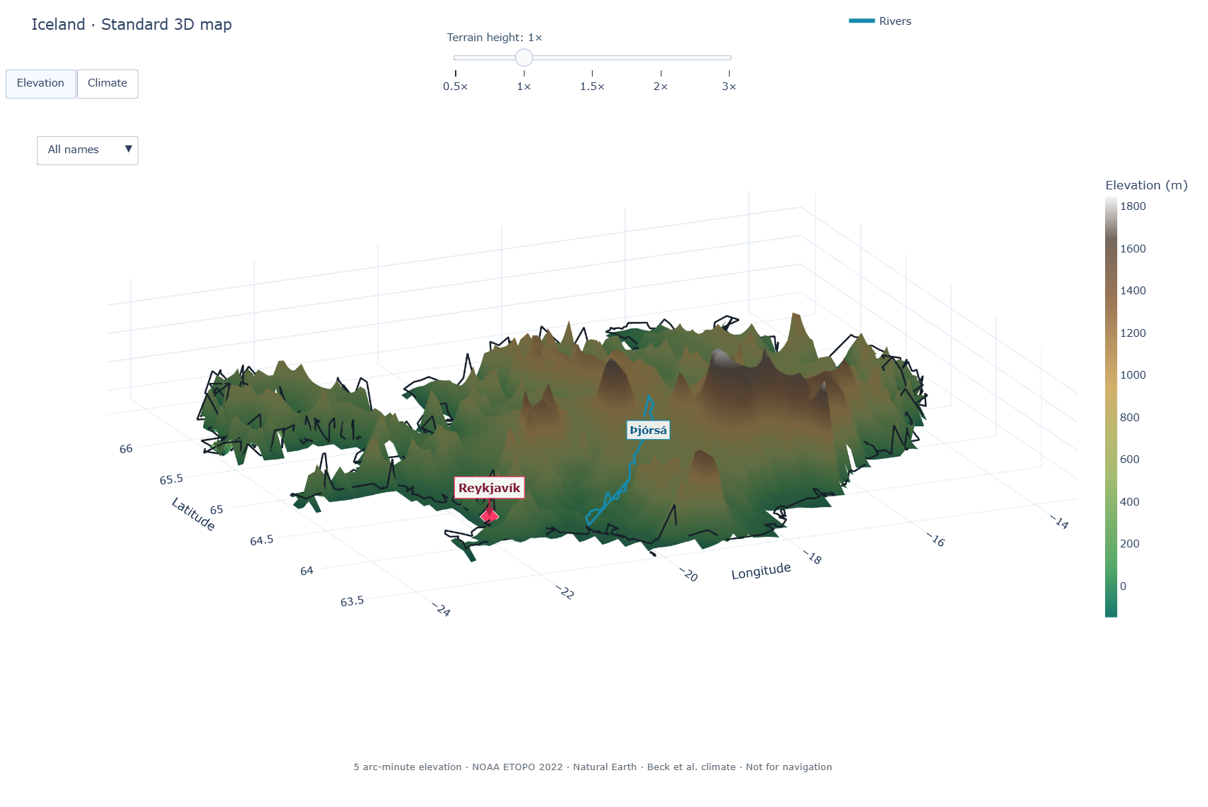
Iceland in the Standard map edition. This complete turn is rendered from the package’s real Plotly figure, with the coastline, Reykjavík, a river overlay, elevation scale, terrain-height and label controls, and source notes. Select it for the complete map guide.
from pyworldatlas import Atlas

with Atlas() as atlas:
    atlas.map("Iceland").show(auto_rotate=True)
The map opens as a rotatable local browser view. Play or pause automatic
rotation, change its speed, switch between Elevation and Climate, or download a
high-resolution PNG. Add maps with
python -m pip install "pyworldatlas[maps]".
A small taste of the atlas
 Brazil
 Japan
Japan Switzerland
 China
China France
 United Arab Emirates
Flag values are Unicode regional-indicator emoji derived from each alpha-2 code. The row above uses local documentation artwork for consistent display; see Discovery tools for the exact API and rendering contract.
Start with something interesting
>>> from pyworldatlas import Atlas
>>> with Atlas() as atlas:
...     brazil = atlas.country("Brazil")
...     print(brazil.flag, brazil.name_in("pt"), "—", brazil.capital.name)
...     print(brazil.highest_point.name, f"{brazil.highest_point.elevation_m:,.0f} m")
...     print(", ".join(river.name for river in brazil.rivers[:3]))
...     print(brazil.climate.dominant_zone.code, brazil.climate.dominant_zone.name)
🇧🇷 Brasil — Brasília
Pico da Neblina 2,994 m
Amazon, Río de la Plata/Paraná, Tocantins
Aw Tropical, savannah
The installed wheel contains ordinary Python source and one read-only database.
Constructing Atlas never contacts a server and does not
load every country into memory.
Explore the atlas
Meet a country
Combine local names, flag emoji, capital, anthem title, motto, demonym, currency, languages, timezones, and source references in one typed profile. Start with Country profiles.
Explore the physical world
Read coastlines, area components, elevation extremes, source-listed rivers and lakes, and represented Köppen-Geiger classes. Visit Physical geography.
Open the terrain
Launch an offline, rotatable country surface with elevation, climate, rivers, and the capital in one call. See Interactive 3D maps.
Measure between places
Calculate great-circle distance, initial bearing, and spherical midpoint from cities, capitals, countries, or coordinates. Try Coordinates and distances.
Explore cities
Search 6,265 populated places, resolve ambiguous names, inspect coordinates, and find nearby cities in Capitals and major cities.
Follow land connections
Discover reviewed neighbors, shared neighbors, shortest land-border paths, crossings, and connected components in Land borders and paths.
Discover and compare
Compose exact filters, inspect nearby capitals, and rank sourced or transparently derived values with Rankings and nearby capitals.
Teach and learn
Create stable samples, deterministic flashcards, compact discovery cards, multiple-choice questions, and Unicode-preserving JSON with Learning activities, Discovery tools, and Serialization.
Search and reuse data
Combine ranked text search with exact profile filters, then export typed results as portable dictionaries or JSON. See Lookup and search and Serialization.
Choose your next step
New to PyWorldAtlas?
Follow the concise Quickstart to install the package, open an atlas, and make your first useful queries.
Want to try it first?
Open the Playground and run the package in your browser with no local setup.
Ready to build?
Copy a complete program from Example programs or browse the focused guides in the Explore the atlas section of the navigation.
What is bundled
Records |
Coverage |
|---|---|
Countries and areas |
248 |
Primary capitals |
241 / 248 |
Populated places |
6,265 |
Selected local-language identities |
248 / 248 |
Sourced English formal names |
240 / 248 |
Anthem titles |
234 / 248 |
Reviewed source-listed mottos |
32 / 248 |
English demonym profiles |
227 / 248 |
Country timezone profiles |
246 / 248, 417 records |
Country-language metadata |
722 records across 245 profiles |
Reviewed land-border relationships |
319 |
Total-area profiles |
248 / 248 |
Land area and coastline |
238 / 248 each |
Highest and lowest points |
240 / 248 each |
Source-listed river records |
188 across 80 profiles |
Source-listed lake records |
187 across 69 profiles |
Plain-language climate summaries |
240 / 248 |
Köppen-Geiger climate profiles |
241 / 248 |
Overview and Standard 3D maps |
248 / 248 each |
Designed for exploration
PyWorldAtlas supports exact lookup and ranked search, immutable typed models, Unicode local names and flag emoji, WGS84 coordinates, distance/bearing/midpoint calculations, deterministic samples and flashcards, land-border paths, profile filters, physical-feature searches, rankings, nearest-capital queries, and optional offline 3D maps. Public results serialize to JSON-compatible dictionaries without losing their source context.
Educational scope
PyWorldAtlas provides offline factual geography for education and reference. It does not provide political commentary or opinion. Values follow documented source conventions, missing data remains explicit, and every field family has a defined source role and publication boundary. Read Educational purpose and editorial policy for the formal policy and Data sources and freshness for exact provenance.
Install
python -m pip install pyworldatlas
The current source checkout can be installed with python -m pip install -e ..